Friday, June 29, 2007

Gwaii Haanas

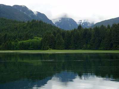
For the past week we have been in Gwaii Haanas, the National Park and Haida Cultural Preserve that encompasses the southern end of the Queen Charlotte Islands. The people who live here call it "The edge of the world", and it is a wild place - we have seen only a couple of of boats, and only one night out of seven have we shared an anchorage. We've encountered many more animals than people - wolves, bears, deer, seals, porpoises, whales, and birds both exotic and common, from black oystercatchers
to sandhill cranes. We made a stop at Hot Springs Island, one of seven places where there are Haida watchmen to greet visitors and protect the ecological and historical elements of the sites. The Hot Springs is understandably popular, and we had a very long soak, with pools all to ourselves. The weather has been largely gray and rainy, with winds from the south, so our southward progress has been halting, and interrupted by a couple of two day stays in anchorages to wait for the winds to drop below
gale force. In the meantime, we grab any break to kayak, and this saves us from claustrophobia and melancholy. We've learned that it doesn't much matter if it is raining; once you are in the kayak and paddling, you can stay quite warm and comfortable. Somehow, when down at the waterline, the scale of man (or woman) to sea and wilderness is reconciled.

Friday, June 22, 2007

Summer Solstice


Summer Solstice, originally uploaded by macatay.

We send along best wishes and high hopes that each of you is enjoying this longest day. It was our goal to be in the Queen Charlotte Islands by the Summer Solstice, so we feel a great sense of accomplishment. We are anchored in a bay that deeply indents the south side of Graham Island, west of the communities at Skidegate and Queen Charlotte. Close by above us are peaks still studded with snowfields. We are exploring new territory, but also hiding out - once again - in protected waters since gales persist in the open water. The Captain is making quite a study of weather faxes, and is developing a personal grudge against a persistent low pressure system that has been stationary a few hundred miles out in the Pacific for the past five days, and is predicted to remain in much the same place for the next five. We expect that means more vistas like the photo above. There is a good reason why the locals call the Queen Charlottes the "Misty Isles".

Monday, June 18, 2007

Sucessful Crossing

We have successfully crossed the Hecate Strait, and are moored at Sandspit in the Queen Charlotte Islands. We pulled up the anchor at first light this morning (4:30 a.m.), and were blessed with mostly clear skies, a calm sea, and enough wind to fill the sails all day. Conditions were especially fortunate, because another storm is forecast - and indeed we already have a nasty, cold wind blowing. We have rented a car, opened a bottle of wine, and plan to ride out this next storm in search of internet
cafes, big totem poles, good coffee, and fresh vegetables. Hooray!

Friday, June 15, 2007

Campania Island


Campania Island, originally uploaded by macatay.

We are anchored in Anderson Passage, a protected nook of Campania Island, not far from the Hecate Strait. Although we have fine, sunny weather, there are gale force winds in the open waters of the eighty mile wide Hecate Strait, which we must cross to reach the Queen Charlotte Islands. So we are waiting for better conditions, glad we were able to find our way in here. As you can see from the chart detail above, there is a maze of channels and islets, which we have been exploring all day by kayak.

We are lucky that a detailed and accurate chart exists, since most of the outer coastal areas are not well mapped. This old chart is a beauty, and tells its own story. The title block announces that the survey was done by W.K. Willis, R.B. Young, and assistants in 1943. We imagine men who were not unhappy to be handed the job of cartography on the wild west coast of Canada, when going off to war was the other option. Our kayak expedition felt like a tribute to their accomplishment.

Thursday, June 14, 2007

Long Days Outside


Long Days Outside, originally uploaded by macatay.

Yesterday we left the Inside Passage and traveled back out to more open waters, closer to the open Pacific. Coincidentally, the weather turned fair. So for two days we have enjoyed the distant views and varied marine life that characterize the outer shore. With fair weather, we are also more aware of these longest days of the year. This sunset photo was taken last night at ten, and there was light in the sky until well after eleven. Dawn comes around four in the morning. It reminds me of being a kid - long days playing outside.

Saturday, June 09, 2007

Storm Hole


Storm Hole, originally uploaded by macatay.

We are anchored in an excellent storm hole. Yesterday morning we listened to the VHF radio weather updates, and took seriously the forecast of storm force winds coming our way. So we altered plans, and skedaddled inland to this anchorage at Clatse Bay, a fiord-like indent into Roscoe Inlet, with mountains all around. Although the barometer has plummeted, we have experienced only rain, clouds, and winds less than five knots. The radio tells us that not too far away there are seas of 3-4 meters, and winds up to 35 knots. As we wait out the storm, we have been busy exploring the shore, where we found amazing wildflowers. We are also diligently studying up on weather forecasting. At last count, we had downloaded five weather faxes, three email weather files, and read chapters in four books. If we've had time to do all that, this has been an excellent storm hole indeed.

Thursday, June 07, 2007

Rock + Tree


Rock + Tree, originally uploaded by macatay.

We have rounded Cape Caution, which means that we are now on British Columbia's North Coast. Whether it is geography or coincidence, we now have cooler and more unsettled weather. Even under gray skies, we venture out in the kayaks. On Penrose Island, just north of Cape Caution, our paddling took us among rocky islets that stand between the anchorage and big water. In this spot, the big water is the Pacific Ocean. Although it is broken some by a web of reefs and rocks, there was a genuine ocean swell, so that as we padded along we were raised up two or three feet, then gently lowered down again. It provided an interesting view of the shore and marine life - like being in a glass elevator. The pairing of rock and tree sketched above were one of the discoveries from this fluid vantage point.

Saturday, June 02, 2007

A Dr. Jekyl Day

This morning we completed a few last minute provisioning errands before leaving Port McNeil. In brilliant sunshine and calm seas, we motored the eight miles over to Sointula. We spend midday strolling from the harbour into the village, poking around in the chandlery, and having lunch at the ever-better cafe. Early afternoon, we snoozed in the sun, waiting for current to move to slack. Mid-afternoon, we headed out around Pulteney Point and into the Queen Charlotte Straits. Contrary to all forecasts
and our expectations, we encountered strong winds, ugly seas, and fog. For four hours we beat into winds 20-30 knots, and took waves and spray over the bow. We reefed the sails again and again; our consolation was that we were making good time. Finally at 6:30, we reached the mouth of Blunden Harbour, where the wind died and the fog cleared. Now we've had dinner in the last sunlight, and it is calm. A Dr. Jekyl day.