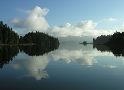
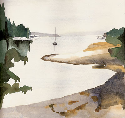
Wednesday, August 30, 2006

Reprovisioning

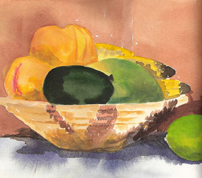
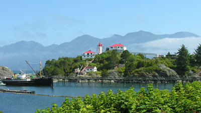
Ucluelet, the port town at the edge of Barkley Sound, offers us the first opportunity in three weeks to replenish our galley. We are delighted to find fresh vegetables and fruit; the things we take for granted in the city – greens, herbs, seasonal fruit – all seems exotic now. After two days in port, our baskets and refrigerator box are overflowing with fresh produce.
And we don’t stop with just one grocery store, but visit each one and find a cross section of life out here on the west coast. There is the big store, the Coop, where everyone shops for food and hardware. Waiting in the checkout line here is a chance to catch up on local concerns: where the fish are biting, when the next commercial fishery will open, the weather, how the tourist season is progressing. Across the main street is the natural food store. We can’t get hardly a word from the proprietress. But when she isn’t busy she sits on the front stoop and talks to the pigeons. A good cross section of the Tofino-Ucluelet region – a bit of new age applied to hard-working fishing towns.

Tuesday, August 29, 2006

The Broken Group


Turtle Bay Anchorage, Barkley Sound, B.C.
N48°55.05
W125°19.64
For the past week, we have been anchored in Barkley Sound, among the cluster of islands known as the Broken Group. Barkley Sound is a big, very open bay cut out of the coast of Vancouver Island, roughly square in shape. The Broken Group sits in the middle of the sound, and its westernmost islands are open to the swell or waves coming in off the Pacific. But as you move deeper into the islands and the coves between them, there is excellent shelter.Broken in this case seems to refer to the islands themselves. There are a few big islands, and, clustered together, they make good sized harbors. But every big island seems to be surrounded by dozens of smaller islets, and the islets surrounded by groups of rocks and reefs and sandspits. This is kayaker’s heaven – an infinite array of passages and short crossings and good beaches and wooded uplands for landing and camping. There are more kayakers here than we have ever seen in any one place – maybe a hundred or more pass by our anchored boat or pass us as we paddle ourselves – each day.

Saturday, August 26, 2006

Clayoquot Sound


Clayoquot Sound, originally uploaded by macatay.

For the past week we have been exploring the bays and passages of Clayoquot Sound. We approached this area with high expectations: we bypassed Clayoquot entirely last time we traveled this coast due to lack of time. Plus this is a storied place in the history of environmental activism. In 1993 over 12,000 people gathered here to protest the provincial government's decision to open 62 percent of the sound to clearcut logging. This was the largest incidence of civil disobedience in Canada's history, and 932 people were arrested.
It is quiet here now, there has been some recent logging, but most vistas remain unscarred. We have had remarkably good weather: morning fog provides contrast to the nearly hot afternoon sun, and we have been knocking around in shorts and tee shirts, and walking barefoot on beaches. From the kayak we can gather huckleberries off bushes hanging near the high tide line. It still feels quite wild here (we were howled at by a lone, long-legged wolf all of one afternoon), but we have enjoyed the company of crews from other boats in most anchorages. Lazy and peaceful, a fine August interlude.

Monday, August 21, 2006

Boca del Infierno and the Bear


Boca del Infierno and the Bear, originally uploaded by macatay.

We went kayaking this afternoon north along the shore from our Nootka Sound anchorage. We found a wonderful bay, which led to a narrow channel into an inner cove. We paddled casually into the channel, realizing too late that there was a strong, strong current sweeping us into the cove. We were barely able to paddle out against the current. It turns out that place is called Boca del Infierno, and it is not a recommended route.

Paddling back to our anchorage, we hugged the steep shoreline to get out of the wind. I came around a corner and looked up to see a big, black bear standing on the rocks above, hanging on to shrubs, and feasting on salal berries. I was way too close - all I could think was that he might fall on me - so I began to back-paddle. The bear was busy and happy, and the wind carried sound and scent away from him, so that he wasn't aware I was nearby. A minute later, the Captain came around the corner, saw the bear, and yelped. This got the bear's attention, and with amazing speed, given his size and the steepness of the terrain, he dropped to all fours and disappeared up through the vegetation.

That's my bear story. The sketch is from memory and won't do the big guy justice, but it's the image I will carry in my mind's eye.

Thursday, August 17, 2006

Nootka


Nootka, originally uploaded by macatay.

Santa Gertrudis Cove, Nootka Sound, B.C.

N49°36.13

W126°37.19

I have wanted to visit Nootka Sound for years, ever since I first began to read about the history of the Pacific Northwest. This is the place where European mariners first made contact with the native Indian people, and where trade and exploration was centered for more than a hundred years.

We reluctantly chose not to visit Nootka two years ago because of Luna, an orphan Orca Whale. Luna had taken up residence in Nootka Sound, and was fond of bumping and rubbing up against visiting boats, especially sailboats. Quite a few boats were badly damaged, and the coast guard warned mariners to take note. We passed right by Nootka Sound.

This year we were able to find solid anchorage in a neighboring bay, and make a shore landing in Friendly Cove, the large bay where the Mowachaht people traditionally had a village and where the European contact began. Our visit coincided with the arrival of the bi-weekly coastal steamer, the Uchuck III, which brings a short visit from tourists and longer ones from hikers who will backpack up Nootka Island and back. We visited the lighthouse and the church, and hiked to village site and headlands. The church has a saint in a niche on the outside, but the inside is full of totems and carvings.

This photo makes the bay and the light house complex look almost Mediterranean, with the August sun shining. You have to imagine how remote this place is, how far from any settlement of any size, and how much at the edge of the open ocean.

Tuesday, August 15, 2006

Wild West Coast

Tahsis, Nootka Sound, B.C.
N49 55.036
W126 39.770
Sunset photos are a fallback position for this blog. Sometimes there is just too much going on, and there is no time for sketching or painting. These past few days on Vancouver Island's Wild West Coast there has been lots of action: brilliant sunny days with brisk, even strong, winds so that there are sails to trim (or reef); warm temperatures that encourage kayaking or sitting around resting up from the latest sailing extravaganza; bread to bake or dinner to cook; other sailboaters with whom to visit and compare notes; whales and otters and sea birds to watch. I'm sure no one will mind the photo of sunset over the Brooks Peninsula.

Sunday, August 13, 2006

Old Charts


Old Charts, originally uploaded by macatay.

The Bunsby Islands, Checlescet Bay, B.C.

N50°06.277

W127°30.892

Among the navigation charts for British Columbia, there are a few that haven't been revised for decades. The one we are using now for Checlescet Bay, is based on a survey done between 1935 and 1937, and its typeface and appearance are entirely different than the newer charts. There is more detail and the place names are located more precisely. Topographic contours appear on all the land surfaces, and the names and heights of most peaks are included. Rocks and shoals are described with symbols that are quite varied, each symbol with its own meaning. It's a beautiful chart, a fine product of a map making tradition.

These waters deserve a detailed chart, because they are strewn with rocks and reefs and islets. This is a kayaker's paradise when the weather if fine, as it has been these last few days. We are anchored now in the Bunsby Islands and kayaked today in kelp, among rocks, in surf, and in still water. We portaged over a strip of beach piled with huge logs tossed up by winter storms, and watched seals chase herring out of the water. A big humpback whale welcomed us to the islands, and a sea otter came by at dinner time.

Friday, August 11, 2006

The Brooks Peninsula


The Brooks Peninsula, originally uploaded by macatay.

Columbia Cove, Checlescet Bay, B.C.

N 50°08.29

W 127°41.52

The Brooks Peninsula sticks west out of the Vancouver Island shoreline like the nose on Pinocchio's face. The first European explorers called it the Cape of Winds. When we listen to the weather reports, there is always a special phrase, something like: "northwest winds, ten to twenty, except south of the Brooks Peninsula, where they will be twenty to thirty." That was the case today, when gale force winds were forecast.

But we've learned that the very high winds occur in the afternoon and evening, and that, on this trip down the west side of Vancouver Island, strong northwest winds are great for sailing. So we pulled up the anchor early, and sailed around the Brooks Peninsula before noon, with following winds of 15-20 knots and cloudy skies turning sunny as we reached the southern end of the peninsula. Indigo had the bit in her teeth, and we got in a few diesel-free miles.

The illustration is of Solander Island, just off the northwesternmost tip of the Brooks Peninsula. Once you've rounded it, you have accomplished the worst part of the passage, so that Solander Island is a geographic icon. I love painting these iconic places; Francis Drake, Captain Cook, Bodega y Quadra, and Vancouver all gnashed their teeth as they rounded Solander Island, and so did we.

Tuesday, August 08, 2006

This just in....


This just in...., originally uploaded by macatay.

The Captain and Toinette just caught this 33 inch Chinook salmon. Thanks to JP's old fishing buddies who sent the Captain encouragement, and especially Greg Moneta who provided the magic formula for rigging the line. The salmon burgers we had for lunch were excellent.

Another Damn Eagle


Another Damn Eagle, originally uploaded by macatay.

Port Hardy, British Columbia

N50°48'978

W127°22.218

Bald Eagles are as common as crows along this coast. Innocent city children who get sent to summer camp in the San Juan Islands learn to refer to the big birds as "another damn eagle". Port Hardy, with its concentration of sport fishing and fish processing plants, has an especially large population. They are so big - we saw one moving across a salt flat from a distance yesterday and mistook it for a large dog. This morning there was an eagle sitting on top of our mast. Still, they are impressive!

We ducked into Port Hardy to sit out a storm, and are now heading for Cape Scott and the west coast of Vancouver Island. It is eleven in the morning, and the Captain and his cousin, Toinette, are motoring slowly and trolling for salmon. Shortly, I will link the computer to the single side band radio and transmit this message and the photo file to the internet via the ham radio service. Wonders of nature and wonders of technology.

Sunday, August 06, 2006

Floating Islands


Floating Islands, originally uploaded by macatay.

Blunden Harbor, Queen Charlotte Strait

N50°50.850

W127°09.599

Echo Bay is a beautiful cove among the islands and channels referred to as the Broughtons. It seems quite sheltered when you are tied up to one of the docks at the small marina there. But when we looked carefully at the chart, and at the surrounding shoreline, we realized that most of the shelter results from a very large concrete float that blocks at least a third of the opening into the Bay. In fact, the float, purchased at salvage, and towed to British Columbia is a remnant section of the Mercer Island Bridge which spanned Lake Washington until it broke apart in a storm in 1990.

Lots of what passes for infrastructure in this part of the world floats: there are floating docks, floating homes, floating resorts. Fish farms are made up of nets suspended from floats, and are tended by guys living in floating dormitories. Whole logging camps, including bunkhouses, cook sheds, dining halls, apartments for the married loggers, and schools for the children exist on barges. Besides the bridge section, Echo Bay has a long row of floating cabins, and two clusters of floating docks. Echo Bay is compact, cozy and secure, but everything that makes it feel that way could be moved away quite quickly.

Saturday, August 05, 2006

Vacation/Vocation

Echo Bay, B.C.
N50°44.04
W126°35.12
In July, it felt like a vacation. We had warm, warm weather, sunshine, and long summer evenings. We had family along as crew members and that was cause for celebration and play.
Now it is August, and the days are ever so slightly shorter. We are further north and there is a chill in the air. It feels like it’s time to get down to business. There is the everyday business of navigation, cooking, cleaning. And then there’s the intermittent business of making plans for the future – for the next passage, then the next season and longer term destinations. If being a vagabond is your vocation, then you must occasionally think about where you will travel next.
The most persistent and soothing everyday occupation for me is drawing, in one form or another. Discovering and capturing patterns in our ever-changing surroundings allows me to make some sense of the world, to bring into focus what might otherwise be a blur, and quickly forgotten - like the white on dark mark made by the long fall of water down a tall cliff face.