Friday, July 27, 2007

Tahsis and the Vegetable Truck

We have made a stop in Tahsis, a village on an inlet that cuts into Vancouver Island north of Nootka Sound. Tahsis once had a large lumber mill, and a population of 3000. The mill is gone, and the population has dropped to 300. Most of the activity here centers around sports fishing, and we are tied up to a friendly marina mostly catering to fishermen. For us, the most exciting attraction in Tahsis (apart from the wireless internet) has been the arrival today of the vegetable truck.
In small towns all along the coast of BC, we have encountered these vegetable trucks. Usually they show up once a week in the summer, bringing a load of fresh produce from truck farms further east. A few years ago in the Queen Charlottes, we bought fresh peaches from a truck just arrived from the Okanagan Valley (Figure out that trip on your road map!). There is a road to Tahsis, even if the last 40 miles is unpaved. The vegetable truck shortens the time and distance produce has to travel, since the tiny store here gets its produce as the last stop on a slow and long distribution chain. We now have a stash of fresh peaches, melons, beans, and other luxuries. It's a good day in Tahsis.

Thursday, July 26, 2007

Settlements by the Surf

In our kayak explorations, we have begun to visit as many sites of traditional indian settlement as we can find. We find hints in books, and look for land that is marked as Indian Reserve on the chart. Virtually all are deserted, and all physical evidence of previous inhabitation is has long gone, except for the middens of shell, the accumulation left by centuries of clams and scallops and mussels caught and eaten. It is the sites chosen for the villages are fascinating to us. They are usually very warm and protected, but nearly always with access to water in multiple directions, including in at least one direction, big open water where there would be good fishing. The photo here is taken just past the village site called Checkaklis, in the Bunsby Islands, south of the Brooks Peninsula. Beyond the line of rocks and reefs in the background is the open Pacific, with its large breakers. A settlement in this place would be rich, wild, wet, and always changing - a village on the edge.

Monday, July 23, 2007

Rain, rain...


Rain, rain..., originally uploaded by macatay.

The past three days, we have experienced steady rain and substantial winds as a storm passed over the north end of Vancouver Island. We've learned some interesting things about rain. One thing is that if the rain drops are large, the fresh rain water can remain suspended as a small fresh water drop on the surface of the ocean. Sometimes the fresh water appears to bounce off the salt water, creating a ripple with a geyser in the middle. The second thing is that the forest floor can become quickly saturated, so that a trail will turn into a mud track, and, eventually, into a long, narrow lake. The third thing is that it takes quite a while for the sea to calm down after a storm passes in this part of the world. Today we motored about seven miles to a new anchorage, experiencing waves and swell in the two to three meter range. The captain keeps referring the the Gabriel Garcia Marquez book, where it rained for forty years.

Thursday, July 19, 2007

South of the Brooks Peninsula


South of the Brooks Peninsula, originally uploaded by macatay.

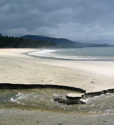
The Brooks Peninsula sticks out from the West coast of Vancouver Island like a sore thumb, and it plays havoc with the winds and the seas. All mariners are familiar with the litany of Environment Canada's west coast forecasts, something like: "northwest winds, 10-15 knots, except around the Brooks Peninsula, where gales are expected". Yesterday, we rounded the peninsula in 20-30 knots of Northwest wind, very boisterous sailing. But, having made that passage, we are enjoying an anchorage in a sheltered cove off Checlescet Bay. We are about as far as one can get from a paved road in British Columbia. We have eagles, rock arches, sea caves, wild rivers to kayak, and - across a small neck of land from the anchorage - the pristine beach in the picture. Truly magnificent, with a view that seems to stretch to Japan. The only prints in the sand are made by bears and heron. The only sounds are the wind and the waves. Just south of the Brooks is a pretty remarkable corner of the world.

Wednesday, July 18, 2007

Sea Otters


Sea Otters, originally uploaded by macatay.

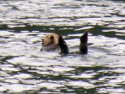
We traveled a long way today - ninety-six miles from Sointula, out and around Cape Scott, and then down to Quatsino Sound. It was an easy passage in calm weather. We were happy with our progress, but really thrilled with the welcome we got as we approached the anchorage in Browning Inlet. The mouth of the inlet was literally teeming with sea otters. There were dozens and dozens resting together in a tight raft - adults of all sizes, babies. Plus, all around the inlet, single otters or pairs. From the boat now at dusk we can see a dozen or more. The photo shows the typical resting position - floating on the back, with feet in the air. The front feet are usually busy - grooming the long fur or eating. Sea otters were wiped out on the BC coast by trade with the Chinese, who prized their fur. A program to reintroduce them, begun in the late 1960's, has been incredibly successful, especially on this northwest coast of Vancouver Island. Encountering them feels like a special welcome back to the wild west coast.

Friday, July 13, 2007

Flummoxed by the Wind


Flummoxed by the Wind, originally uploaded by macatay.

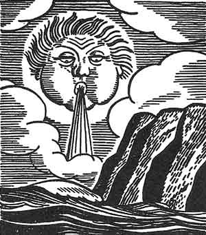
We aren't the first sailors to be frustrated by winds that refuse to blow in our favor. On Indigo, we have been reading Rockwell Kent's "Voyaging", a book he wrote and illustrated about his adventures sailing in the Strait of Magellan and trying to reach Cape Horn. In a small boat Kent and a companion encountered plenty of rough weather, had to wait out interminable headwinds, and finally, out of desperation, had to hike overland to get close to Cape Horn. We won't be hiking to reach the west coast of Vancouver Island, but we are frustrated by an odd occurrence of non-seasonal southerlies, which make rounding Cape Scott and the Brooks Peninsula difficult. So we are spending the days provisoning, kayaking, and enjoying some relatively summery weather. A much better situation than Rockwell Kent's in the wilds of Patagonia.

Saturday, July 07, 2007

Albatross and Dolphins


Albatross and Dolphins, originally uploaded by macatay.

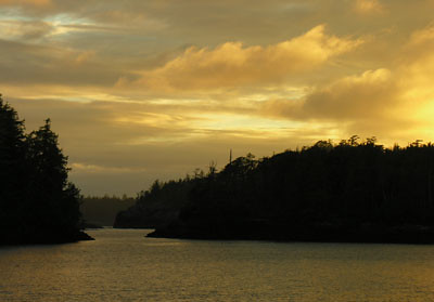
The past three days we have been traveling rapidly. Tuesday we crossed back over the Hecate Strait on a day of benign weather. When we left our Queen Charlotte's anchorage very early in the morning, we were tailed by big Albatross for the first part of our journey. They were looking for the easy pickings typical of the local fishing boats. We nearly ran over a sleeping whale, but otherwise had an easy crossing and made our way cautiously into a remote bay on Aristazabel Island on the outer BC coast. From the anchorage we could see out into the Hecate Strait, and were able to enjoy the sunset shown above. Wednesday, we had a fine day of downwind sailing to reach the Seaforth Channel, and today we traveled further south, and are now just north of Cape Caution. Yesterday late in the afternoon, we spent a fine half hour idling mid channel while a herd of dozens of Pacific White Sided Dolphins performed their acrobatics around our boat, leaping, looping, diving and generally surprising and amusing us. Such a treat to encounter creatures who appear to operate from shear joy.

Sunday, July 01, 2007

Burnaby Narrows


Burnaby Narrows, originally uploaded by macatay.

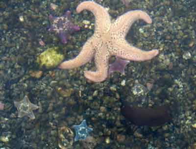
Burnaby Narrows is a smooth water shortcut on the north-south route along Moresby Island. It is a narrow passage between Burnaby Island and Moresby Island, and very shallow. At the very lowest tides, most of it is dry; at high tide, a good sized boat can carefully pick its way through. Because it is so narrow and shallow, its waters are always moving fast, and that fast water supports a wealth of marine life. We spent the last three days anchored at the south end of the narrows, and made low tide and high tide transits in the kayaks. At high tide it is majestic, and you are aware of the grassy meadows along the banks, deer grazing. We caught a glimpse of the sandhill cranes that nest here. But the best show is at low tide, when you can glide along in six inches of water over a galaxy of star fish and anemones, clams and limpets, sea urchins and sea cucumbers. This photo is one of many taken from the kayak, with the camera face down in shallow water. I could not have imagined a display like this in a place that is so far north - we are learning so much about the richness of this extreme environment.