Sauvie Island Abstraction
 Portland, Oregon: We watch the winter rains - only one dry day in the last thirty. We also watch the river levels, which are fluctuating just short of flood state. This is of interest because we need to move Indigo back from the boatyard on the Columbia to our moorage on the Multnomah Channel, and high water means that Indigo's mast won't fit under the Sauvie Island Bridge. So someday soon, probably in the rain, we will return to Scappose by circumnavigating Sauvie Island - downriver to St.Helens, then back up the channel.
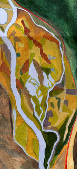
 Thinking about this route, I revisited a painting begun several years ago based on maps and satellite photographs of the Portland area. The geography of the waterways and the variety of land uses all got turned into paint. A new experience for the wintertime, armchair sailor.
posted by s. v. Indigo at
3:44 PM
![]()


1 Comments:
Satellite photos? Try:
earth.google.com
It is free and VERY cool!
Post a Comment
Subscribe to Post Comments [Atom]
<< Home